Log in
All resources
Create a design
68 Free Artworks of Gulf Coast
bibliothèque nationale de france
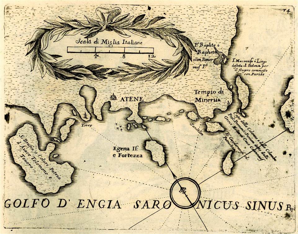
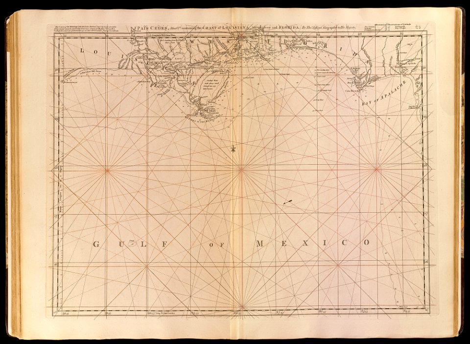
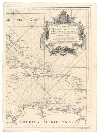
maps by tomas lopez
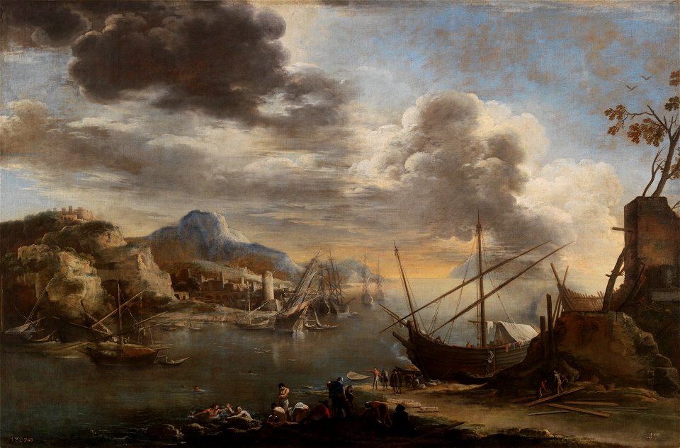
oil on canvas
juan de la cruz cano y olmedilla
covens en mortier
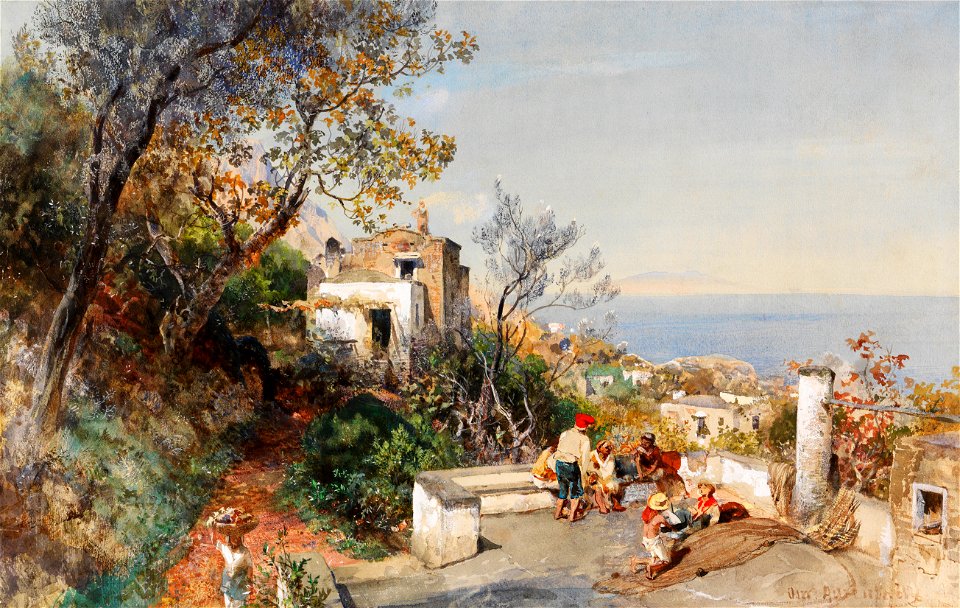
19th-century landscape paintings of italy
19th-century paintings of coasts
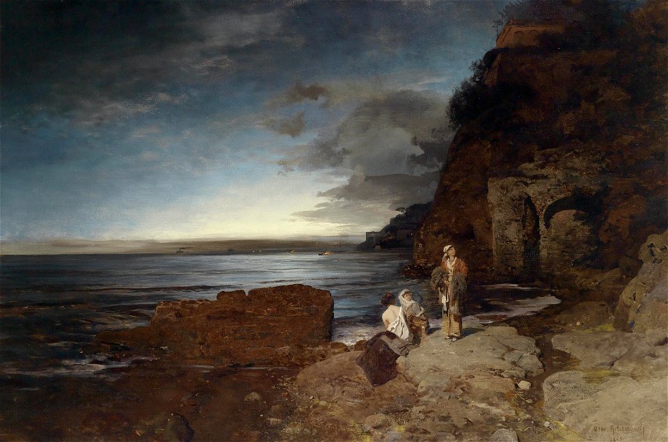
italy in paintings by oswald achenbach
works by oswald achenbach ordered by date
unidentified locations in italy in art
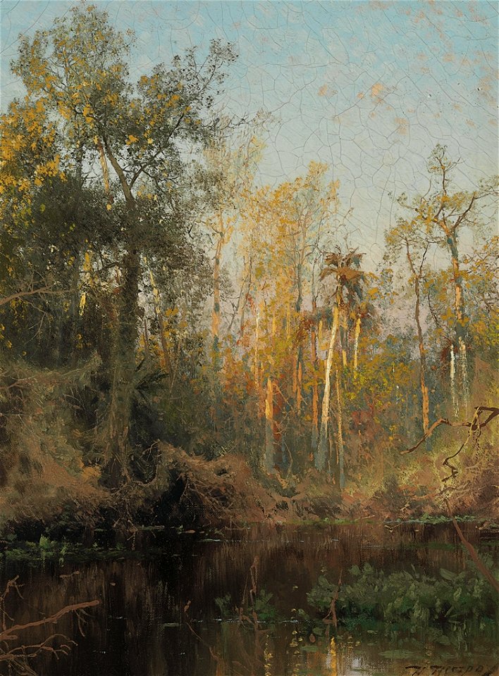
paintings by hermann ottomar herzog
gulf coast
superseded paintings
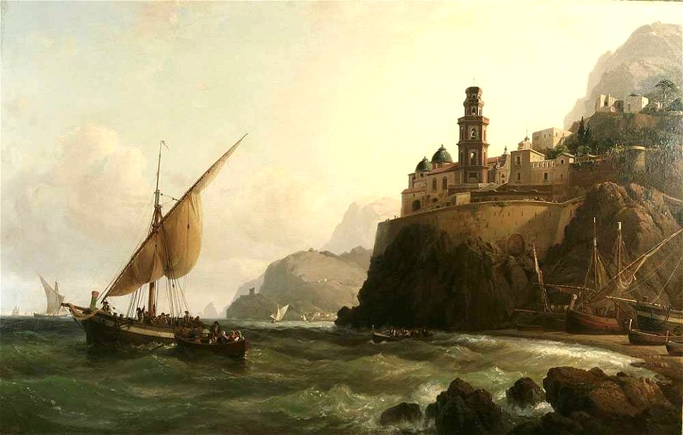
atrani
geographical illustrations by coronelli
maps in the library of congress
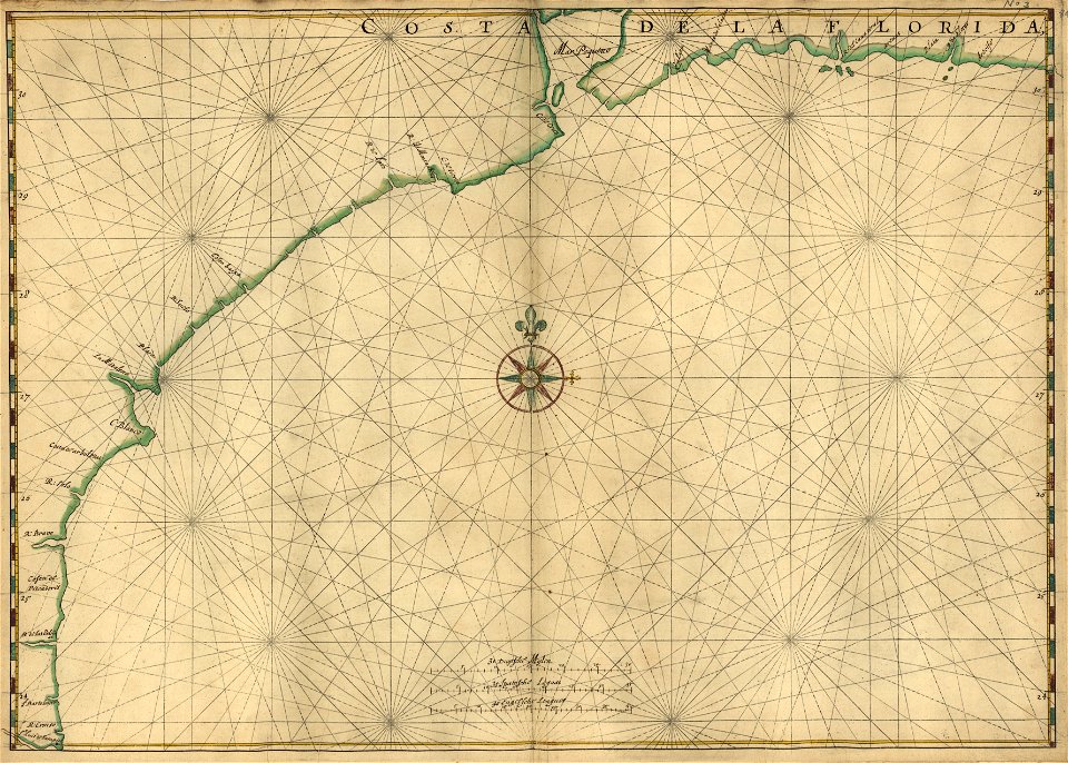
old maps of florida
maps in the library of congress
old maps of florida
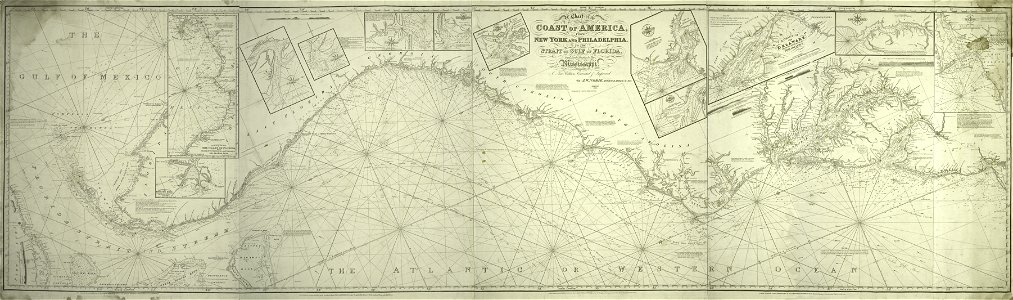
old maps of the gulf of mexico
maps by thomas jefferys
paintings by salvator rosa
paintings of sailboats
map images supported by wikimedia uk
1856 maps
19th-century landscape paintings of italy
gulf of naples
18th-century landscape paintings of italy
cetara
water transport in vyborg
lucas janszoon waghenaer
map images supported by wikimedia uk
1856 maps
sorrentine peninsula
gulf of naples
old maps of cameroon
old maps of liberia
16th-century maps of the persian gulf
maps of the gulf of suez
arthur joseph meadows
oil on canvas
landscape paintings in the state art museum of altai krai
landscape paintings by mikhail konstantinovich clodt
1903 paintings
1903 in texas
a grotto in the gulf of salerno by joseph wright of derby
landscape paintings by joseph wright of derby
italy in paintings by oswald achenbach
düsseldorf school of painting
1750s maps of central america
maps by tomas lopez
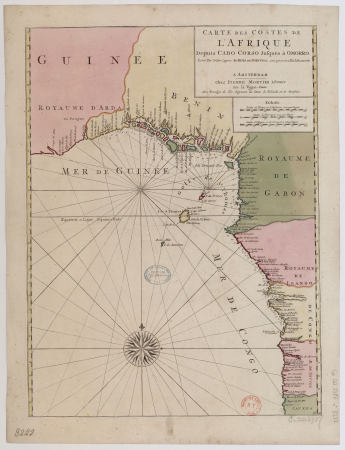
17th-century maps of africa
maps from gallica
16th-century maps of the persian gulf
16th-century maps of the red sea
juan de la cruz cano y olmedilla
1755 maps of north america
1750s maps of central america
maps by tomas lopez
description
historical
description
historical
bibliothèque nationale de france
cartouches by tomas lópez
1780s maps of tunisia
1780s maps of libya
the english pilot (1771)
post-impressionism
juan de la cruz cano y olmedilla
1750s maps of the caribbean
17th-century maps of west africa
1650 maps of africa
het uuterste ofte oosterste deel van de oster zee, beslooten tegens ruslandt lijfflandt, oost finlandt, in welcken de twe opperste ofte veerste laetplaetsen sijn van de geheele oosterse navigatie, te weeten... - btv1b53235861c
old maps of the gulf of finland
oil marine paintings by joseph vernet
gulf of naples in art
1780s maps of tunisia
maps by tomas lopez
het uuterste ofte oosterste deel van de oster zee, beslooten tegens ruslandt lijfflandt, oost finlandt, in welcken de twe opperste ofte veerste laetplaetsen sijn van de geheele oosterse navigatie, te weeten... - btv1b53235861c
bibliothèque nationale de france
zee caerte vande custe van lijfflant begrepen rontsomme de grooten inham vande rijgsche zee, soe tselfde hem verthoont ende op doet - luca ioannis aurigarius autore ; ioannes à doetecum fecit - btv1b53235807k
bibliothèque nationale de france
zee caerte vande custe van lijfflant begrepen rontsomme de grooten inham vande rijgsche zee, soe tselfde hem verthoont ende op doet - luca ioannis aurigarius autore ; ioannes à doetecum fecit - btv1b53235807k
bibliothèque nationale de france
het uuterste ofte oosterste deel van de oster zee, beslooten tegens ruslandt lijfflandt, oost finlandt, in welcken de twe opperste ofte veerste laetplaetsen sijn van de geheele oosterse navigatie, te weeten... - btv1b53235861c
bibliothèque nationale de france
de zee kuste rontomme oesel ende een deel van curlandt beginnende van dagher oort tot derwinde, also hem tlandt daer verthoont, ende in zijn ghedaente is - luca ioannis aurigarius autore ; ioannis à... - btv1b532358081
bibliothèque nationale de france
de zee kuste rontomme oesel ende een deel van curlandt beginnende van dagher oort tot derwinde, also hem tlandt daer verthoont, ende in zijn ghedaente is - luca ioannis aurigarius autore ; ioannis à... - btv1b532358081
bibliothèque nationale de france
de zee kuste rontomme oesel ende een deel van curlandt beginnende van dagher oort tot derwinde, also hem tlandt daer verthoont, ende in zijn ghedaente is - luca ioannis aurigarius autore ; ioannis à... - btv1b532358081
bibliothèque nationale de france
de caerte ofte zee custen van pruijssen, met zijne haffen ofte groote rivieren, vander memel off tot heel tho, alsoe tlant aldaer in zijn wesen is - luca ioannis aurigarius aut. ; ioannes à doetecum fecit - btv1b53235794k
bibliothèque nationale de france
die custe van lijfflandt, met de eijlanden daer beneffens, also hem dat landt aldaer verthoont ende in zijn ghedaente is, van ekeholmen off tot sijburchs ness tho - lucas ioannis aurigarius inventor... - btv1b532358064
bibliothèque nationale de france
18th-century maps of sri lanka
maps by thomas kitchin
die custe van lijfflandt, met de eijlanden daer beneffens, also hem dat landt aldaer verthoont ende in zijn ghedaente is, van ekeholmen off tot sijburchs ness tho - lucas ioannis aurigarius inventor... - btv1b532358064
bibliothèque nationale de france
de caerte ofte zee custen van pruijssen, met zijne haffen ofte groote rivieren, vander memel off tot heel tho, alsoe tlant aldaer in zijn wesen is - luca ioannis aurigarius aut. ; ioannes à doetecum fecit - btv1b53235794k
bibliothèque nationale de france
de caerte ofte zee custen van pruijssen, met zijne haffen ofte groote rivieren, vander memel off tot heel tho, alsoe tlant aldaer in zijn wesen is - luca ioannis aurigarius aut. ; ioannes à doetecum fecit - btv1b53235794k
bibliothèque nationale de france
die custe van lijfflandt, met de eijlanden daer beneffens, also hem dat landt aldaer verthoont ende in zijn ghedaente is, van ekeholmen off tot sijburchs ness tho - lucas ioannis aurigarius inventor... - btv1b532358064
bibliothèque nationale de france
fisher's drawing room scrap book/thubare
fisher's drawing room scrap book plates
maps by jakob van der schley
history of hormuz island
johannes leupenius
jacobus robijn
old geological maps by jean-etienne guettard
jean étienne guettard
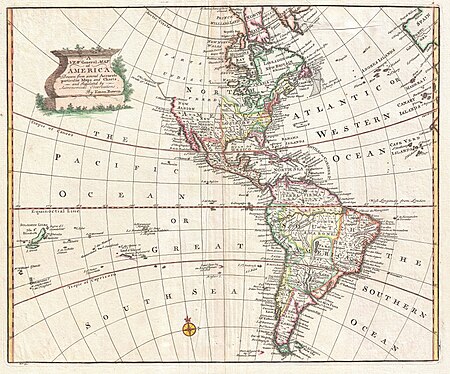
18th-century maps of north america
1708 maps of north america
old geological maps by jean-etienne guettard
jean étienne guettard
lawrence h. slaughter collection of english maps, charts, globes, books and atlases
covens en mortier
18th-century maps of the malay archipelago
18th-century maps of southeast asia
lawrence h. slaughter collection of english maps, charts, globes, books and atlases
covens en mortier
1696 maps of the caribbean
1690s maps of mexico
maps by john cary
1801 maps
british columbia in the 1860s
saturna island
antonio della valle
amphipoda
africa in the 18th century
1794 maps of africa
1803 maps of the caribbean
maps by john cary
paddle steamers in art
clement drew
paintings in the national maritime museum, london
oil paintings of the royal museums greenwich
watercolor paintings
watercolorists
1740s maps of the americas
1747 maps of north america
1 - 68 of 68
/ 1